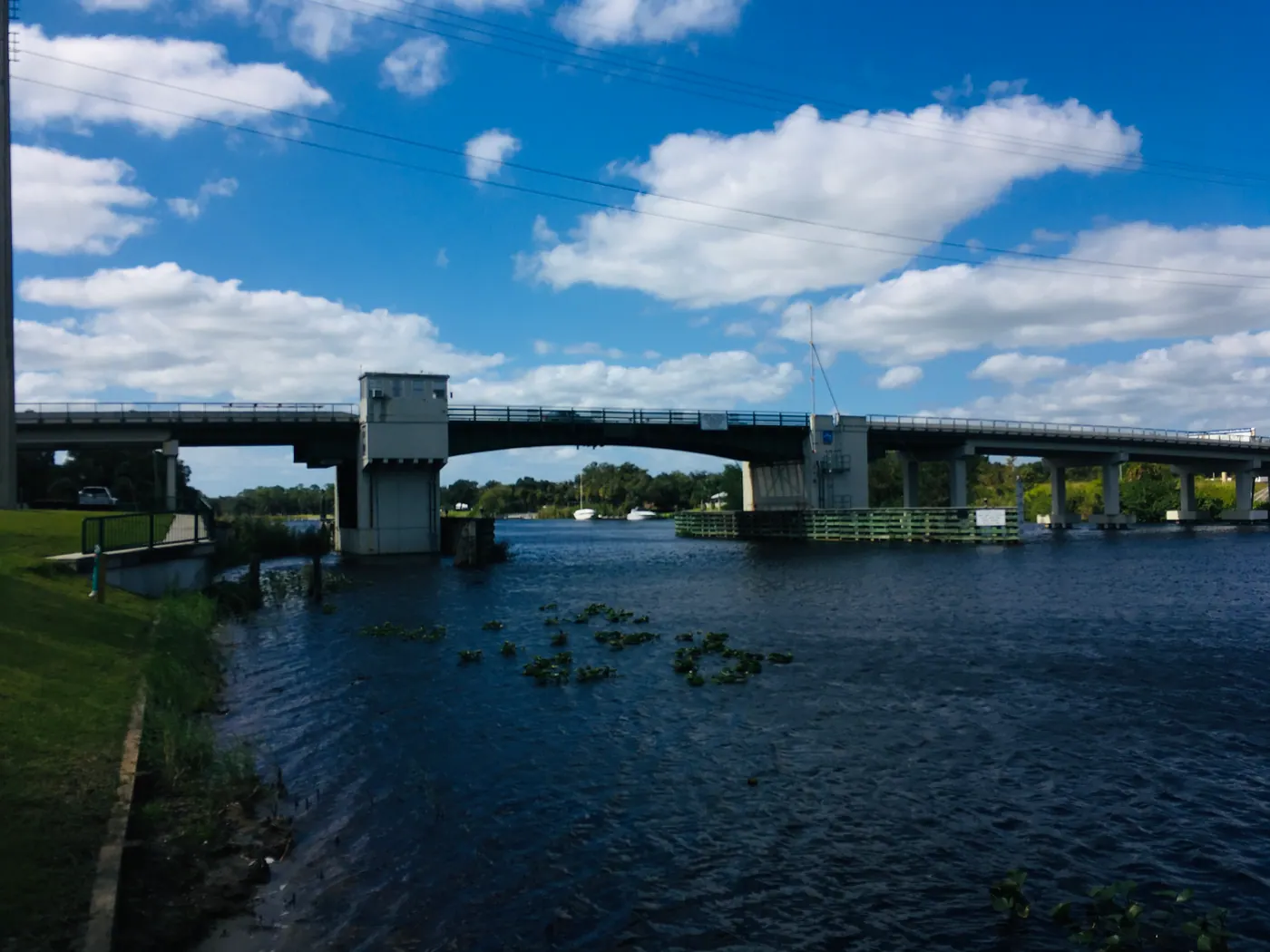
The Caloosahatchee River at LaBelle’s drawbridge
The Caloosahatchee at the SR 29 drawbridge · 2020Photo: Sanibel sun · CC BY 4.0 · Details
BEFORE THE HIGHWAY

The river
was the road.

Stand by the Caloosahatchee a minute. There’s more moving through this town than the traffic on SR 80.
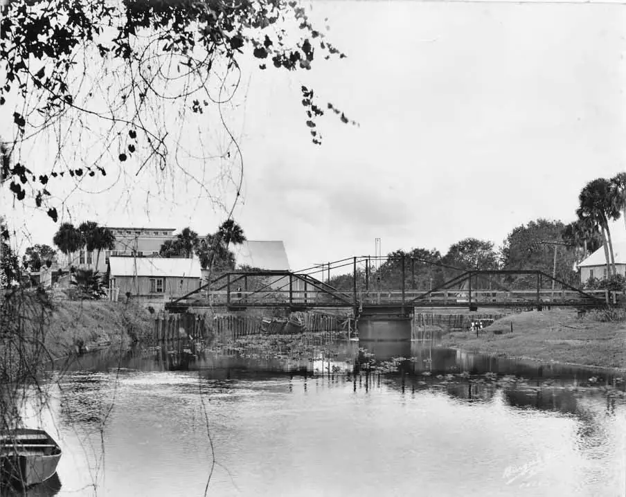
Black-and-white 1925 view of the Caloosahatchee River and a bridge at LaBelle, Florida, with trees along the bank.
River and bridge at LaBelle · November 13, 1925Photo: Burgert Brothers · Courtesy, Tampa-Hillsborough County Public Library System. · Public Domain Mark · Details

Freight, mail, and a way to town

The National Register study describes boats bringing supplies from Fort Myers and smaller motorboats carrying mail and passengers. Before today’s road connections, the river tied the settlement to the wider world.

New routes, new ambitions

In the 1920s, roads and rail changed that pattern. The same study records the highway through LaBelle in 1926 and rail service beginning in mid-1927. It also documents Henry Ford’s acquisition of Goodno’s holdings and rubber experiments at Fort Thompson in the 1920s.

These were overlapping chapters in a changing agricultural town, not a single moment when river life ended.

A story that starts earlier

The river’s history did not begin with ranchers or steamboats. Indigenous histories need their own sources and voices. For Seminole history and living culture, start with the Ah-Tah-Thi-Ki Museum, the Seminole Tribe of Florida’s museum on Big Cypress Reservation. It is a regional visit, outside downtown LaBelle.

Spend some time beside it

The Caloosahatchee is part of the Okeechobee Waterway. Watch the river from public places, or check current dock information if you arrive by boat. Our parks and outdoors guide has a few places to begin.

THE RIVER, THEN AND NOW

Bridges, boats, and the Caloosahatchee.

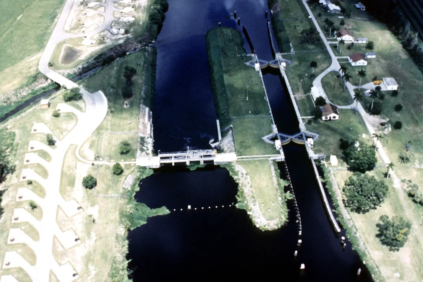
Archive dates follow each source. The lock is upriver in Glades County, not in LaBelle.
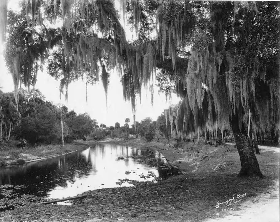
Black-and-white 1925 photograph of the river at LaBelle, Florida, with trees reflected in the water.
River scene · November 13, 1925Photo: Burgert Brothers · Courtesy, Tampa-Hillsborough County Public Library System. · Public Domain Mark · Details
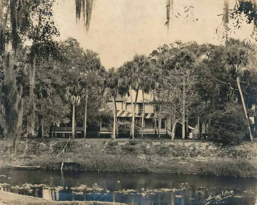
Black-and-white 1925 view of a house on the far bank of the river in LaBelle, Florida, framed by trees.
A home seen from across the river · November 13, 1925Photo: Burgert Brothers · Courtesy, Tampa-Hillsborough County Public Library System. · Public Domain Mark · Details
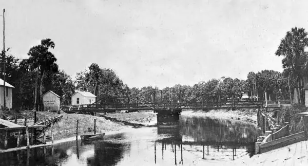
Historic black-and-white photograph of the former swing bridge over the Caloosahatchee River in LaBelle, Florida.
The former swing bridge over the Caloosahatchee · date not stated by the sourcePhoto: Photographer unknown · State Archives of Florida, Florida Memory · Public Domain Mark · Details
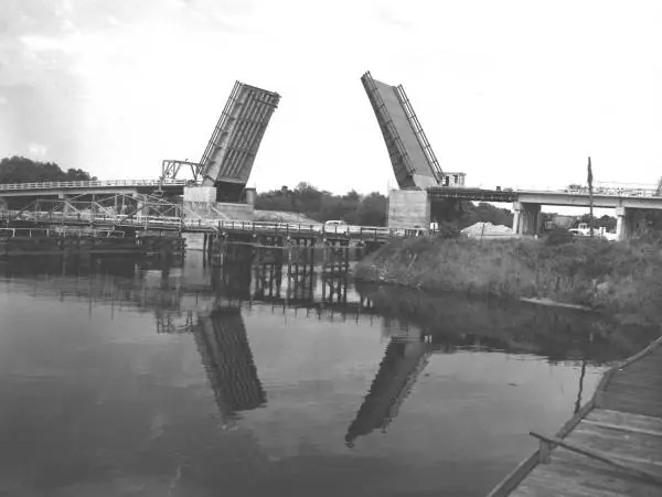
Black-and-white 1959 photograph of the new State Road 29 bridge under construction next to the original swing bridge in LaBelle, Florida.
The SR 29 bascule bridge under construction beside the old swing bridge · March 28, 1959Photo: Photographer unknown · State Archives of Florida, Florida Memory · Public Domain Mark · Details
Ortona Lock and Dam on the Caloosahatchee River near LaBelle, Florida, with the lock chamber and surrounding vegetation.
Ortona Lock and Dam, upriver in Glades County · 1999 photograph Ortona Lock and Dam is in Glades County, upriver from LaBelle, not inside the city limits.Photo: U.S. Army Corps of Engineers · Public domain · Details
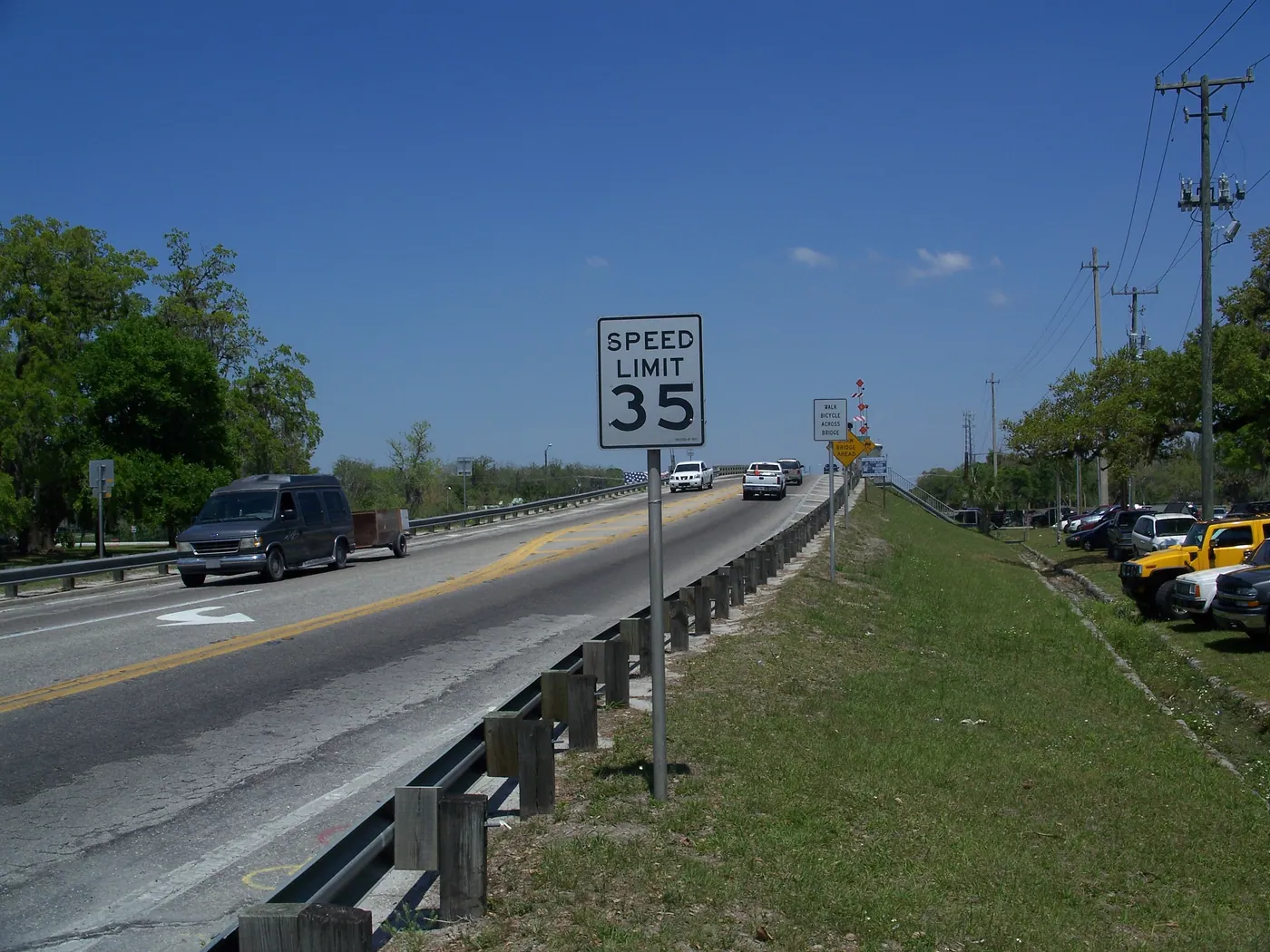
Road approach to the SR 29 drawbridge in LaBelle
The road approach to the SR 29 drawbridge · 2010 photographPhoto: Ebyabe · CC BY-SA 3.0 · Details